CARTO-
Franklin Jarrier has maps of the underground / metro and tramway systems of various cities in different countries on his web site
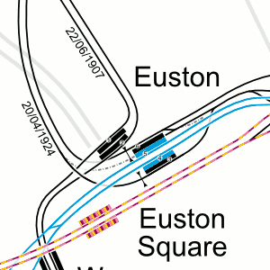
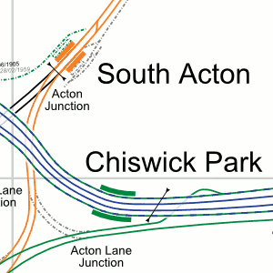
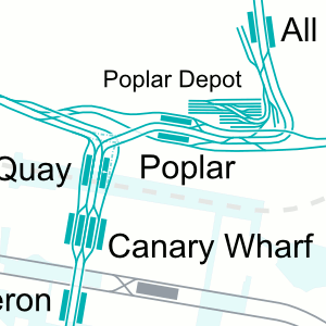
These are not the standard “tube” maps. They are highly detailed track layout maps that show sidings, crossovers, depots, disused tracks, and some other features.
The maps are shown to scale in a geographical layout so you can see just how far a system covers in relation to the surrounding town or city. See the route the tracks take as they go from one end of the line to another. See how one line interacts with another.
Zoom right in on the map to get the finer details
The London map shows the Underground, Overground, DLR and some NR tracks
The maps are available to download as a graphic (.png) file or PDF format if you
want to look at them on your own PC. The maps are also available for on-
HOMEA site
A few bits of information related to the London Underground, with some downloadable items
LONDON’S TRANSPORT FORUM
Covers the various types of transport in London. View as a guest or register to join in the discussion