Carto-
Franklin Jarrier has maps of the underground / metro and tramway systems of various cities in different countries on his web site
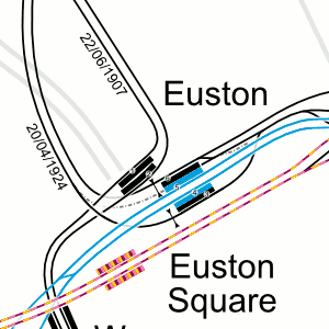
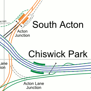
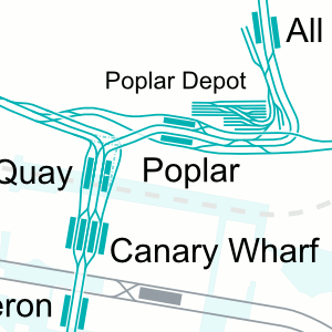
These are not the standard “tube” maps. They are highly detailed track layout maps that show sidings, crossovers, depots, disused tracks, and some other features.
The maps are shown to scale in a geographical layout so you can see just how far a system covers in relation to the surrounding town or city. See the route the tracks take as they go from one end of the line to another. See how one line interacts with another.
Zoom right in on the map to get the finer details
The London map shows the Underground, Overground, Main line, DLR, and Tramlink (see examples below)
The maps are available to download as a graphic (.png) file or PDF format if you
want to look at them on your own PC. The maps are also available for on-
The maps can also be downloaded to view on a smart phone. Because of the map size
(A0), a fast processor on the mobile is preferable because there is a lot of screen
refreshing if you are scrolling at maximum zoom. It is best to download the PDF version.
Apart from what phone is used, what app is used can affect the performance. I’ve
tried the pdf map on an Alcatel OT-